Monday, May 27, 2013
Severe Weather Outbreak Likely In Kansas This Afternoon
Currently heading towards, Salina, KS to get in position for a potential severe weather outbreak this afternoon. Things seem to be shaping up nicely for a fairly localized tornado outbreak along the warm front/triple point in N Kansas. Stay tuned to SevereVideos.com and TVNWeather.com for live streaming video and updates!
Monday, March 25, 2013
First Chase May Be About A Week Away!!!
With the beginning of Spring 2013 starting off very cold due to the infamous "Greenland Block" pattern keeping much of the continental US below average temperature-wise, there has been a much below normal amount of severe weather in the month of March so far this year. Models are finally beginning to agree that temperatures across the country will begin to rise this week... and possibly be back to or above normal by this weekend!
Although still a week out, and still too far away to make a detailed/confident forecast, a few days early next week have my attention. The last few GFS runs have shown a system developing early next week that could potentially bring a severe weather threat to the Texas Panhandle, Western Oklahoma, up through Western Kansas and Nebraska.
There is also some promise for this system to be a multi-day severe weather episode, possibly towards the Mid-Mississippi Valley area by Wednesday.
Although the latest model runs have got many storm chasers like myself drooling over the possibility of finally getting out on the road next week, it is FAR too early to be making any concrete plans. For example, the system I have talked about was an entire day earlier in previous model runs. Basically, just the fact that a decent looking system showing up in the models for next week is enough to get me excited at this point, just for the fact that it means there is a chance for a chase or two!
Stay tuned for further updates!
Donovan
Although still a week out, and still too far away to make a detailed/confident forecast, a few days early next week have my attention. The last few GFS runs have shown a system developing early next week that could potentially bring a severe weather threat to the Texas Panhandle, Western Oklahoma, up through Western Kansas and Nebraska.
 |
| GFS Forecast Surface Dewpoints, Tue April 2nd, 18z (1:00 PM) |
 |
| GFS Forecast Surface Dewpoints, Tue April 3rd, 18z (1:00 PM) |
Stay tuned for further updates!
Donovan
Wednesday, March 6, 2013
Photos of 2012
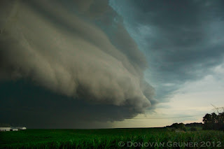
Although 2012 proved to be a real test to the sanity of storm chasers and severe weather junkies nationwide, it was not without its opportunities to snap a few nice shots.
Here is a few of my favorites from 2012.
Here is a few of my favorites from 2012.
Labels:
chasers,
chasing,
hail,
lightning,
meso,
photo,
photography,
severe,
storm,
supercell,
thunder,
thunderstorm,
tornado,
tornadoes,
videos,
weather
Subscribe to:
Comments (Atom)


