 |
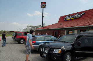
| Chaser convergence at Pizza Hut |
Last Friday, I headed out on a 3 day chase adventure with Brandon Sullivan and Connor McCrorey. We targeted a bit southwest of the OKC area, being models were showing a discrete supercell firing to the southwest. We stopped in El Reno for some pizza before the chase, and met up with Tony Laubach, Colt Forney, Kevin Rolfs, Scott Peake, and others. Towers began to go up shortly after finishing our pizza, and we decided to head northeast.
After sitting in a field watching towers trying and dying, I began to get a little nervous. However, a tower just to our west was able to break the cap, and rapidly became a monsterous supercell.
This storm was a very beautiful storm, however it just didn't have what it took to produce. It came very close for a little bit, and despite the plethora of reports of funnel clouds and rapidly rotating wall clouds, OUN didn't seem to want to tornado warn it.
 |
| This should probably be tornado warned... |
After watching this beast for a few hours, it became apparent it probably wasn't going to produce. However, it did drop a good sized swath of 3"+ hail, and was very photogenic. We eventually decided to start heading north to set up for Saturdays target, but got sidetracked shooting lighting. As we were shooting lightning, the storm we were shooting went tornado warned. We decided to head a bit south and west to check it out.
 |
| N Oklahoma Tor Warned Supercell around 10 PM |
We made it to Topeka early Saturday morning, and slept a few hours. We then headed to Omaha to pick up Brett Wright from the airport. We then decided to get Pizza Hut again, being we'd had luck every time we had eaten there before a chase. We looked over data over a few pizzas, and headed out. After watching a Cu field on satellite for a while, we began to see the towers in the distance. We decided to head a bit closer to get a better look. We watched one of the towers begin to dominate, and eventually grow into a monster supercell just NW of Omaha.
After going through a few splits, the right split seemed to be getting it's act together. It strengthened, and then rooted itself into the warm front. It then turned hard right, and began to look like it may produce. We stopped in Mapleton, Iowa for a fill up, and the storm went tor warned. We headed a bit to the west to get a better look, and may have seen a few brief spin-ups. The inflow at our location was so strong, it ripped the drivers door open, and bent the hinges. We couldn't get the door shut, so I ended up tying it shut with my shoelaces in hopes of salvaging at least one tornado.
Video shot by Brandon Sullivan Wicked Wind Media
Shortly after the door incident, we found ourselves watching a nice cone funnel come down with a little dust getting kicked up underneath. It rapidly intensified, and became a 3/4 mile wide EF3. Unfortunately, it hit the town of Mapleton, where we had just filled up. We decided to head into town to see if we could do anything to help, and try to figure out a way to fix the door for Sunday's chase.Later on, we got some absolutely incredible structure. The storm eventually produced several tornadoes for us, but the amount of trees made it nearly impossible to shoot any photos or video. NEVER EVER CHASE IN NORTH WISCONSIN UNDER ANY CIRCUMSTANCES EVER!!! After seeing what appeared to be a huge wedge cross a few miles in front of us, we decided to just about give up... when we got a radar update showing an intensifying couplet just to our west. We sat still and watched a wall cloud spin across the road in front of us, but it just couldn't put anything down. Due to a lack of roads and how far north we were, we decided to call off the chase and begin heading south to Rockford to stay at my parents house.
It was a great weekend, however it could have gone better. Unfortunately due to the door issues Saturday, we missed 10+ tornadoes after dark, including a violent wedge, twin stovepipes, and a multi-vortex tornado. I've even heard rumors that there was 3 tornadoes on the ground at one point. That storm is definitely one of the most powerful storms I've ever witnessed... and is likely one of the most powerful on record. Congratulations to everyone who got some amazing video and pictures of these spectacular nighttime tornadoes! At least I got to end the trip nicely by spending a night at home and seeing my best friend, Sputnik!
 |
| Sputnik |
It now appears that tomorrow could be a fairly significant severe weather outbreak across parts of the Southern Plains/Ozarks. A line of discrete supercells could develop along a dryline from SE Kansas to NE Texas in the evening. Tornadoes, some strong, are possible with any supercell that is able to develop. Potential may ramp up a bit towards sundown due to a strengthening low level jet around 00z to 01z. I currently like Central to East Central Oklahoma due to the positioning of the jet max, enhancing lift due to the left exit region over this area. SPC has issued a Moderate Risk, and I've been having good luck with those lately. If you live in areas affected by this system, pay attention to watches and warnings and stay tuned to local news or NOAA weather radio for more info.
Donovan Gruner


No comments:
Post a Comment